Spectacular Romanesque abbeys of the Meuse

St. Willibrord’s basilica, Echternach, Luxembourg, seen from the Wolfsschlucht hiking trail.

Last weekend, with Covid-19 containment measures kicking in again across Europe, my old friend Marcel and I managed to sneak away for a classic (and fully legal!) Dead Emperors’ Society road trip. The original plan was to visit Cologne for its famous 12 Romanesque churches, but Germany imposed quarantine on people from our part of Holland so that didn’t work out.

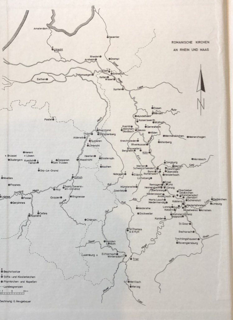
Fortunately a few years ago I bought a used copy of Kubach & Verbeek’s Romanische Kirchen an Rhein und Maas. It is old but it is still the authority on anything Romanesque in the Rhine and Meuse valleys. Cross-checking with travel restrictions and church concentrations, we ended up in Luxembourg.

Kubach/Verbeek 1971, inside cover.

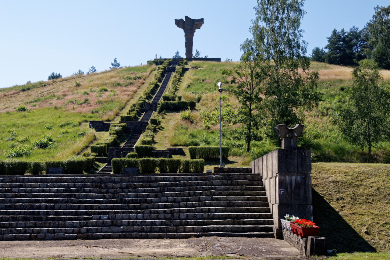
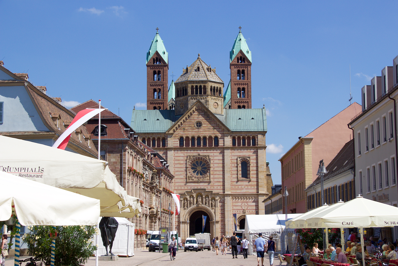
After some wine-tasting (mandatory on our trips, this time we sampled Luxembourg Crémant and Pinot Noir) we ended up in the small town of Echternach, perched on the river Sauer which today forms the border with Germany. Echternach abbey was founded in 698 by Saint Willibrord, a monk from Yorkshire who was responsible for Christianizing much of what today is The Netherlands.

Saint Willibrord’s gown (c. 700 AD?), in Echternach abbey’s reliquary chapel near the West entrance.

The feeling of standing face to face with ancient objects and buildings, especially if they’re over 1000 years old, for me almost goes beyond description – a magical historical sensation probably comes closest. This is what I enjoy so much about our trips – coupling academic art historical knowledge with experiencing buildings and objects firsthand.

First floor west chapel of the Princely Abbey at Corvey, consecrated 844 AD.

On our first trip, many years ago, we saw the c. 800 AD ‘Westwerk’ of the Abbey at Corvey in Central Germany, and Bishop Bernward’s bronze church doors at Hildesheim. Standing so close to works of art that have survived a full millennium made me go very quiet – and also makes me want to return time and again.

These medieval buildings and objects, and their histories, appear to be much better known and loved in Germany than they are in the Netherlands. We can blame the romanticism of 19th century nationalists: when they looked for an ideal historical example for Bismarck’s united Reich, they ended up with the Ottonian to Hohenstaufen periods, c. 1000-1300, as Germany’s Golden Age. Like much 19th century nationalist mythology, it has stuck until today.

Echternach Abbey, from the northwest. The church was heavily damaged in the 1944 Ardennes Offensive; most of what you see here is a post-war reconstruction. The Romanesque design of the façade was inspired by the church at Paray-le-Monial.

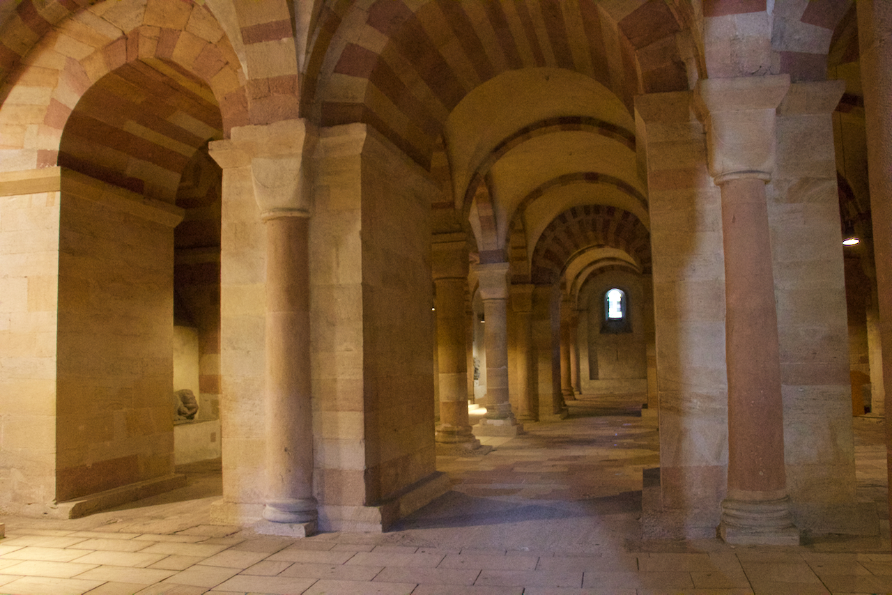
In contrast to Echternach’s restored church, the 8th century crypt is original and this is where I experienced my strongest ‘historical sensation’. We were surprised to find that Kubach/Verbeek did not cover it – until the penny dropped: this Carolingian crypt is simply too old to be considered Romanesque.

Barrel vaulted ceilings in the 8th century crypt at Echternach. This is a cross-view of the five-nave crypt, from North to South, showing four of the five naves.

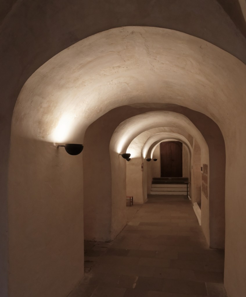
One of the naves holds a staircase that descends to the ‘Willibrord fount’, where spring water comes bubbling up – a reference to St. Willibrord’s baptisms.

Another nave has two Merovingian sarcophagi, embellished with engraved lines, that have been dated to the 7th century AD!
The central nave’s ceiling has sketches for a fresco that are allegedly 11th century. This dating is not very convincing. If true, the drawings must have been heavily restored.

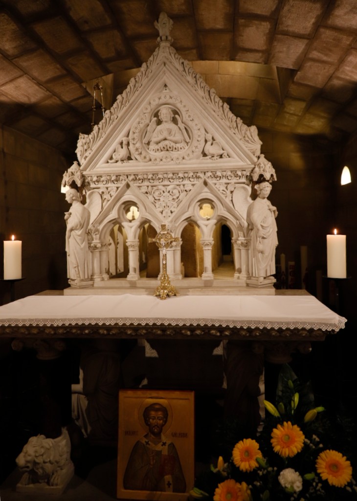
The abbey’s most prized relics, Saint Willibrord’s bones, sit in a sarcophagus that is also Merovingian, right below the altar of the church upstairs. You can just see it in the picture – it is hidden inside an elaborate neo-gothic baldachin in white Carrara marble, created by Genovan artist Guiseppe Novi in 1906. You can also see the hole in the roof of the crypt that leads directly to the altar above – establishing a direct spatial link between the priest celebrating mass upstairs and the relics of the Saint down below.

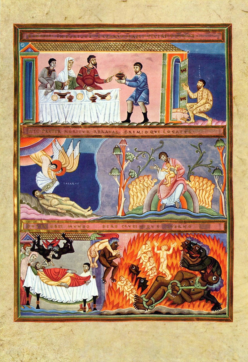
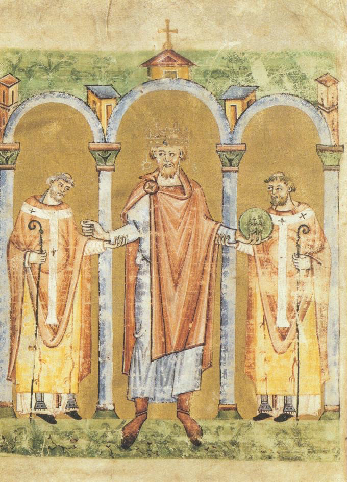
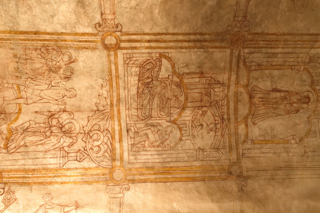
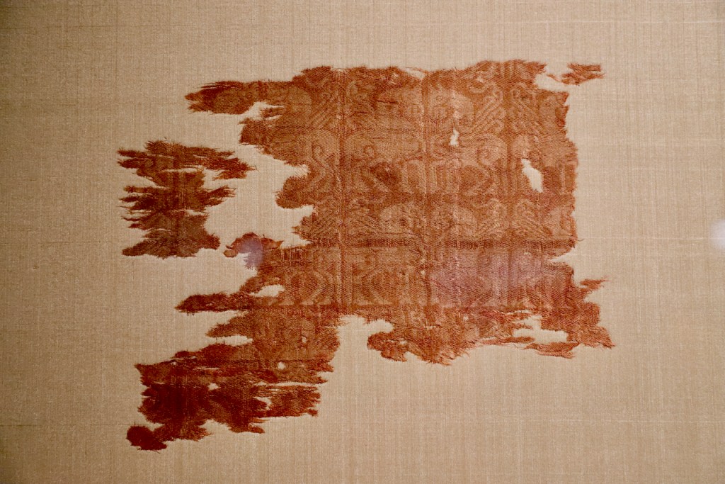
Abbeys from the era of the Carolingian Renaissance, like Echternach, contained important scriptoria, workshops where books were copied and illuminated with magnificent miniatures. Echternach is famous for creating many Gospel Books. These evangeliaria contained the four gospels of the New Testament. The most famous is the Codex Aureus Epternaciensis or Golden Codex of Echternach from c. 1040, kept at the Germanisches Nationalmuseum at Neuremburg. It is unfortunate for the abbey museum that none of the books created at Echternach have remained in its collection: all they have are images and facsimiles. The originals of these precious books have ended up in libraries across Europe – not so surprising, as they were often commissioned from the Abbey by imperial princes for use as gifts.

Front cover of the Echternach Gospel Book (facsimile). By Zinneke at Luxembourgish Wikipedia, CC BY-SA 3.0.

In case of the Codex Aureus its history is unclear: the book’s front cover, with its ivory centrepiece, is some 50 years older than the manuscript and was probably commissioned by Emperor Otto III and Empress Theophanu, but the manuscript was completed after their deaths, and scholars do not agree on the book’s original beneficiary.

Echternach Abbey, nave, with alternating columns and blind arches.

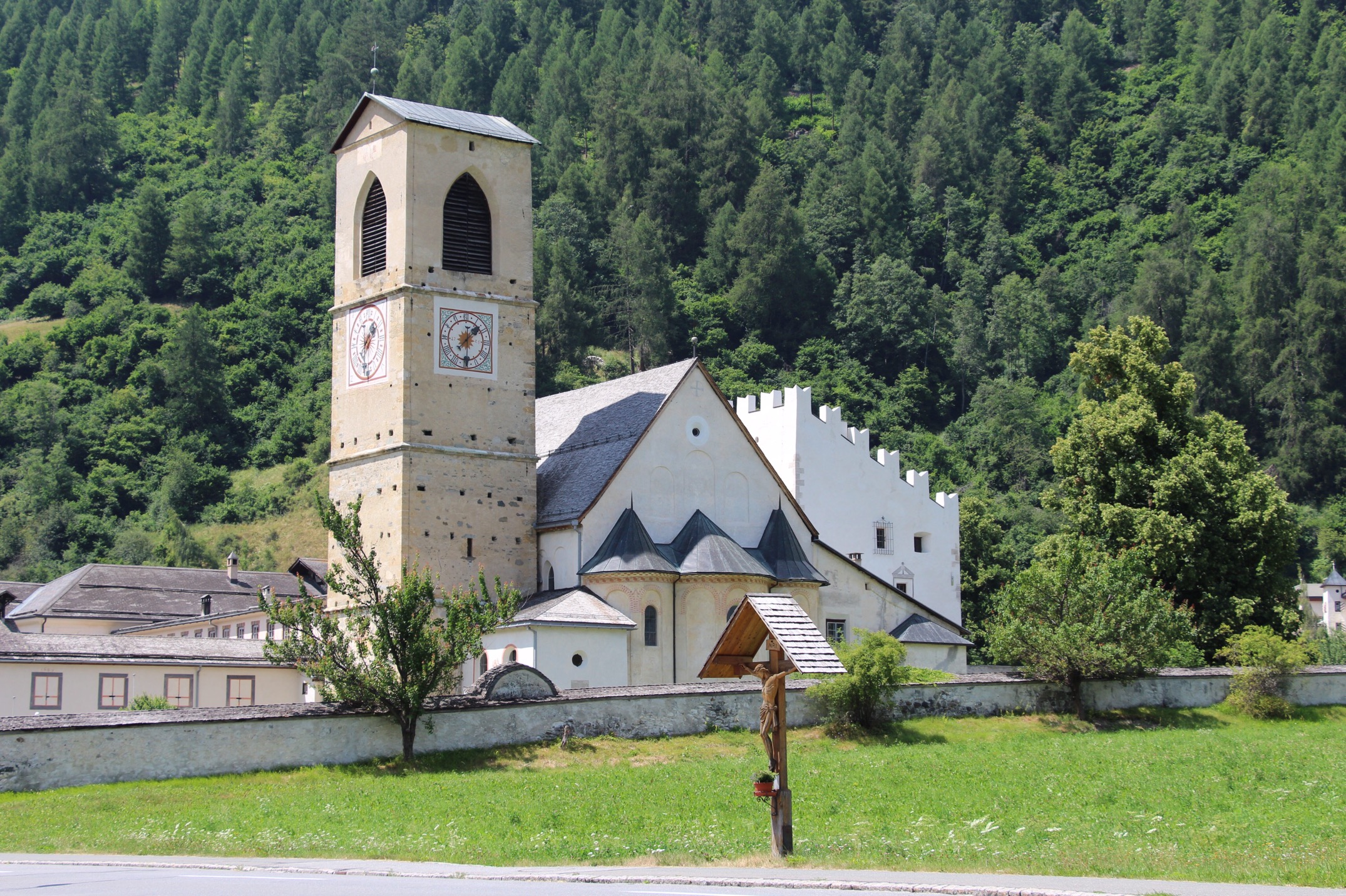
Moving to the Romanesque nave of the (reconstructed) abbey, there are alternating columns, with modified corinthian columns in the middle of each blind arch, and square pillars, some in alternating layers of natural stone, linking the arches. This feature created the link with another treasure listed in Kubach/Verbeek and our next destination: the former abbey church of St. Amelberga at Susteren, in the Limburg province of the Netherlands.

St. Amelberga’s basilica, Susteren, Limburg, The Netherlands

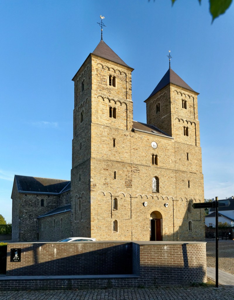
This wonderful but not very well known abbey was founded in Merovingian times and had Willibrord, who later moved to Echternach, as one of its abbots. Willibrord used it as a welcome stop on his frequent travels from Utrecht, the seat of his archbishopric, to the abbey at Echternach. Two later bishops of Utrecht, Gregorius and Albericus, were buried here at their deaths in 755 and 784.

St. Amelberga, southeast view.

After its destruction by Viking invaders, King Swentibold of Lorraine restored the abbey and gave it to Amelberga who became the first abbess and educated Swentibold’s daughters there. The current building dates to c. 1060, and the abbey remained a Damenstift until Napoleonic times. In the 19th century, it turned into a parish church.

Nave and walls of St. Amelberga at Susteren. Note similar alternating columns and blind arches to Echternach. The capitals of the pillars here are ‘die-shaped’ instead of Corinthian, a typical

The crypt at Susteren is a special and unusual feature. It is above ground and protrudes beyond the apsis of the church.

Northeast view of St. Amelberga at Susteren. The low construction on the left is the external crypt.

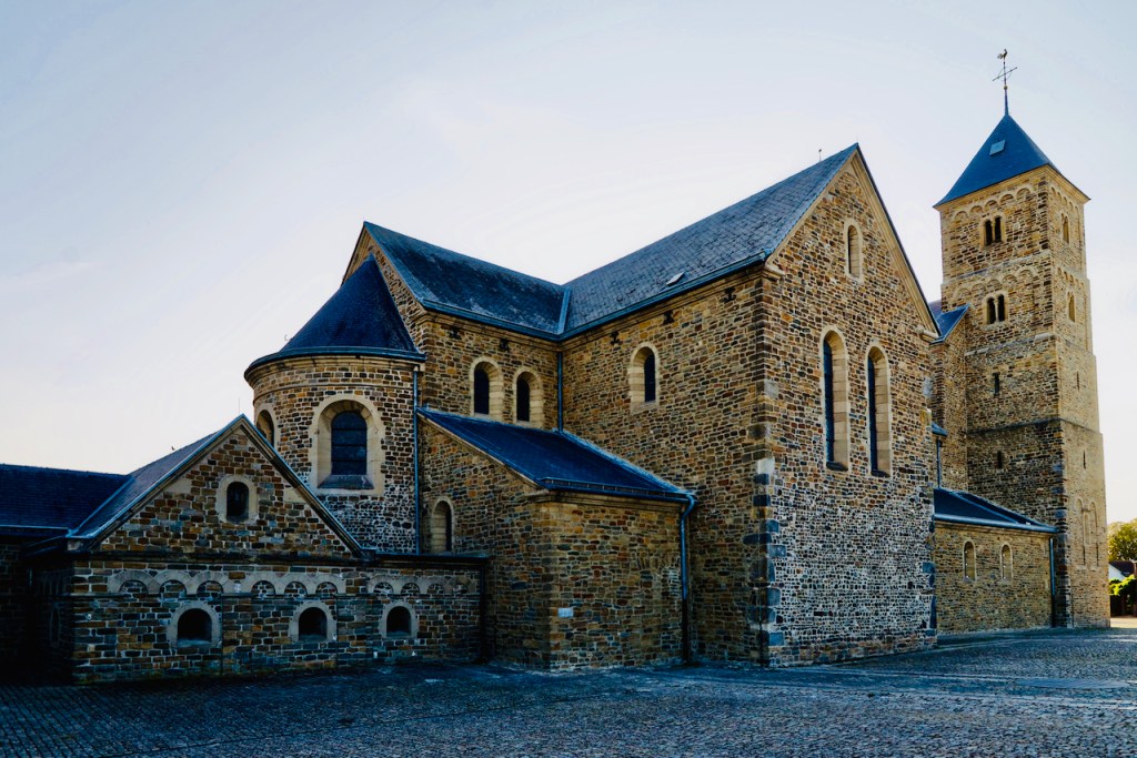
A crypt of this type is very uncommon – its only prominent counterpart is in the abbey of Werden, near Essen:

The external crypt (bottom right, 1059) of St. Liudger’s, another former abbey church, at Werden. Drone shot from a 2019 trip.
Interior of external crypt at Susteren. A five-nave design like Echternach’s, but with cross-ribbed vaulting.

This crypt is Romanesque, in contrast to Echternach’s, but it also contains a Merovingian sarcophagus. The story of how we got into the crypt – and the church’s treasury – is typical of the joys of seeking out lesser known architectural gems like these:

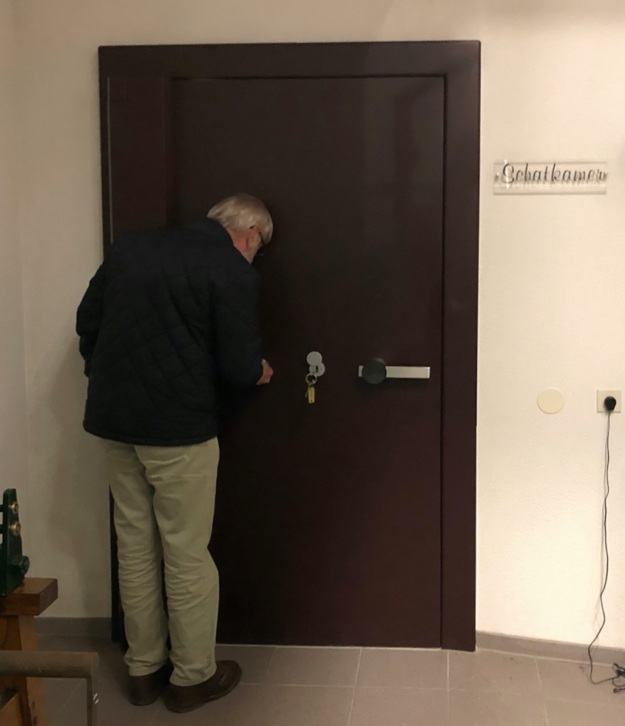
The church’s front door was unlocked when we arrived around 5 pm on a Sunday, allowing us to enter the vestibule. The church interior was visible, but only through a glass wall. So we walked around the exterior, took photos, and then the caretaker arrived to close the front door for the night. When hearing that we were art historians, she graciously took the time to turn on the lights and give us a complete tour of the church. Then, when she was about to close up, the church’s official guide, Mr. Wil Schulpe, passed by on his evening walk and was also happy to take us into the church’s vault and show us all its treasures.

Fabric of St. Alberic’s tunic, Persian, 8-9th c. AD, showing juxtaposed winged horses. Susteren church vault.
Gilded silver relief plates from a relic shrine or altar antependium, 10th c. AD, Susteren church vault.
Amelberga Shrine, 11th-19th c., Susteren church vault

The church’s treasure also contains a famous illuminated manuscript, now being restored at Liège: the Susteren Gospel Book (Evangeliarium van Susteren).

Miniature from the Gospel Book of Susteren (c. 1174). The Abbess Imago van Loon offers the Gospel to Saints Gregory and Albericus.

In contrast to several gospel books named after Echternach, in this case the book wasn’t created at Susteren – it would not be realistic to expect the Stiftsdamen, daughters from royal and noble families to spend their days painstakingly copying texts like ordinary monks – but it is named after the abbey because it now resides there.

Finding these incredible treasures in a church vault that is normally closed to the public, a church that is also (unlike Echternach) completely off the beaten tourist track was a wonderful conclusion to this weekend trip.

Best regards from the Dead Emperors’ Society – keep exploring!

All photos: (c) Robin Oomkes.

The Battle of Cedynia (24 June 972) – medieval history with a communist twist

dni_cedyni_cpzh_2015_11-1030x687
Living History-buffs at the Cedynia Days festival. Pic: Dni Cedyni 2015

Some 50 miles east of Berlin lies the Polish town of Cedynia. Since the 1960s, on every 24th of June it is the scene of a festival commemorating the Battle of Cedynia, which took place there in 972 CE. Reenactment aficionados replay the battle in mediaeval costumes, there are open air concerts, and blacksmiths and potters display their trades.

The battle itself, then, took place over 1000 years ago, between the forces of German count Odo I and Polish warlord Mieszko. Odo was as a vassal of German emperor Otto I. His attack on Mieszko’s lands was against the wishes of the Kaiser, as Mieszko himself, the first documented ruler of Greater Poland, also paid tribute to the empire. Odo was unable to beat his Polish opponent and the battle ended in a truce. A year later, Otto, the old emperor, would lay down a judgement settling the matter, but the conflict was only fully resolved when Mieszko married a German noblewoman some seven years later.

But why does this ancient and forgotten battle (at least until after World War Two) get so much attention now? The reason is Cedynia’s situation on the Oder river, part of the famous Oder-Neisse line.

IMG_1707
The bridge on the Oder river at Cedynia. This frontier crossing was reopened as late as 1993. Pic: Robin Oomkes

When Stalin demanded that Poland should be shifted westwards at the end of World War Two, this happened at the expense of German territories like the easternmost part of the Prussian province of Brandenburg. The town of Cedynia (which was called Zehden until 1945) became Poland’s most westerly city. All German-speaking citizens were deported from the area, and the town became the new home of refugees that Stalin had chased from the east of pre-war Poland.

Map_of_Poland_(1945)
The Polish shift from East to West. The red line on the left is the Oder-Neisse line.

The selection of the Oder-Neisse line as the new Polish-German frontier had a long diplomatic aftermath. The GDR accepted the new border as soon as 1950, but the Federal Republic (or West Germany) didn’t formally agree until 1970. The German reunification treaty of 1990 again acknowledged the border specifically, hoping to assuage Polish fears of German expansionism. So, in the 1950s and 60s, it is understandable that Poland’s communist regime was not quite certain of the status quo of its new western frontier. Politicians knew perfectly well that the area had been German for a long time, and the state did its best to justify its claims on the territory. Clearly they weren’t fully convinced that the atrocities inflicted upon Poland by the Nazis during the war were justification enough for some compensatory annexation.

IMG_1698
1972’s Polish eagle monument, on a hilltop half way between Cedynia and the Oder river. Pic: Robin Oomkes

So, Polish politicians started looking for any historical sources that could justify their


Continue reading

A year in the saddle – Emperor Henry II’s 1017 itinerary

How utterly exhaustive a mediaeval itinerant king’s life must have been (and how blessed we motoring tourists are today) is shown by this map of the travels that Emperor Henry II undertook throughout his territory in 1017 alone.

Map of Henry II's 1017 itinerary
Emperor Henry II’s 1017 itinerary. From: Ehlers, C. (ed.), Mitteralterliche Königspfalzen (Göttingen 2002).

Kings and emperors travelled their realms from palace to palace until the late Middle Ages, accompanied by the whole court. They did this to confirm their authority over the local rulers governing in their names, to rule as judges, show themselves to the people and gain legitimacy, to meet the lords of the realm, often to wage war but also simply because agriculture in those days did not produce enough surplus to feed a large and demanding court in one place for too long.

As we can see, Henry started his itinerary in the mountainous Harz region in middle Germany. We have more detailed information on some parts of his trip than for others as much of the data comes from the chronicle of Thietmar, the Abbot of Merseburg, who probably recorded the nights spent in his own vicinity (eastern Saxony and the Harz) more precisely than those in other parts of Germany. Moving away from the Harz area, Henry travelled southwest to Ingelheim and Mainz, where he celebrated Easter. After that, the Emperor sailed down the river Rhine and visited an important meeting with the grandees of the realm. He subsequently made his way East, back to the Harz mountains, following the ancient royal road known as the Westphalia Hellweg. On the way, Henry attended Pentecost celebrations at the Werden monastery near Essen.

Emperor Henry II entering a church, accompanied by two bishops. Staatsbibliothek Bamberg, Msc. Lit. 53, fol. 2v

The large distances the Emperor travelled towards Ingelheim (in Spring) and Frankfurt (in December) show that royal attendance to important feasts like Easter and Christmas was planned long in advance. Towns and abbeys vied with each other to have the monarch spend important religious festivals at their location.

Emperor Henry spent the summer, as was often the case, waging war. In the year 1017 he campaigned against Poland – unsuccessfully. The campaign is indicated on the map in dotted lines – but doesn’t show the full extent of the army’s eastwards travels.

Returning from Poland, the Emperor again visited Saxony and the Harz, and then started on a southwestern tack towards Frankfurt for Christmas, with a wide diversion via Bamberg and Würzburg. All together, Henry and his court would have travelled a minimum of 2600 km in this year. Estimating daily progress at 25 km, this means over a hundred days spent in the saddle.

Despite the fact that historians have been able to reconstruct royal itineraries for most individual years of the early German imperial era (usually based on royal charters from archives, which were always signed with a date and place), it is often not quite clear why the court chose a specific itinerary and places of lodging. Possibly palaces and abbeys were selected based on available dwellings, a good relationship with a host, such as an abbot, available food stores, or just the personal preference of the Emperor. An important factor was also whether the  palace was part of the royal domain, thus belonging to the King himself, or was the property of some other authority. The importance and prestige of a palace could be judged by the number of visits paid by the monarch over the years, and, as we’ve seen, the religious festivals attended there.

Just as we do not really know why the court selected certain routes of travel, we are not sure why certain parts of the realm were skipped, sometimes for years on end. Were they too insecure for royal travel? Or was the King so sure of his authority in those places that he could afford to leave them unvisited?

You may have noted that I use “King” and “Emperor” intermittently here. “King” would be proper, as the perambulating mode of government was part and parcel of being German King, whether the King would eventually be crowned Emperor or not. The palaces of the royal domain also fell to the King upon his election. But obviously “Imperial” has a ring of its own (explaining why German Kings went to such great lengths to get the Pope to crown them as Emperors), and many stopping places on the Emperor’s itinerary started calling themselves “Imperial Palaces” from an early date. Certainly repeat visits by Emperors lent a special appeal to such palace town. This, for example, explains why Henry III’s palace at Goslar, restored at the height of the 19th century mediaeval revival, is referred to as the “Kaiserpfalz” (imperial palace), not “Köningspfalz” (royal palace).

What fascinates me about itinerant Kingship is how any man could be capable of sustaining this exhausting way of life, repeating this great journey throughout a very large empire year upon year, continuing to reconfirm their authority to their imperial grandees, while maintaining focus on governing the country as a whole.  Of course, the fame and respect that the office of King or Emperor commanded would have helped, as would the fact that royal authority was very much based on ancient magical and sacred traditions, and most people were honoured by a royal visit.

Just by following mediaeval Kings along their itinerary for a bit, driving along provincial roads from town to town, you start realising the mind-boggling tenacity these people must have had to up this rate of travel, on horse-back, in wind and weather. The modern traveller’s reward, as it may have been the ancient Emperor’s, is to discover yet another of Germany’s spots of beauty, whether it’s an ancient cathedral, a monastery or a royal palace, hidden in provincial towns that are insignificant today, but whose treasures bear witness to a culturally rich and diverse past.

The Emperor’s new castle, part I – the Haut-Koenigsbourg in Alsace

From Ht. Koenigsbourg castle, you can see across the Alsace plain to Germany's Black Forest and Kaiserstuhl (Emperor's Chair)
From Ht. Koenigsbourg castle, you can see across the Alsace plain to Germany’s Black Forest and Kaiserstuhl (Emperor’s Chair)

Alsace, a beautiful region on France’s north-eastern edge, is blessed by a sunny climate, vineyards that produce some of the world’s finest whites, and picture-perfect villages of half-timbered houses that have overflowing flower baskets on every window sill. But Alsace’s wealth, and its strategic location on the left bank of the Rhine and at the foothills of the Vosges Mountains,  have also caused it to be the focus of land-grabbing campaigns by both French and German rulers. In fact, although originally part of the (German) Holy Roman Empire, Alsace has been forced to switch sides between France and Germany so many times since the days of Louis XIV that even many locals have lost count.

Vineyards are never far away in Alsace - like here, directly behind Turckheim's Grand'Rue
Vineyards are never far away in Alsace – like here, directly behind Turckheim’s Grand’Rue

In 1870, the Franco-Prussian war ended up in the creation of the German Reich, and caused Alsace, and its sister region of Lorraine, to be attached to Germany. By the time Wilhelm II was crowned German Emperor in 1888, the Alsatians’ hearts and minds had still not exactly warmed to their new rulers. In a curious mix of Romance/Germanic cultures, most Alsatians had been quite happy to be French, even though the local language, Elsässisch (which is still spoken by older people today) is a German dialect.

The castle seen on a particularly grim day. Due to its situation far above the plains below, you may end up with your head in the clouds.
The castle seen on a particularly grim day. Due to its situation far above the plains below, a visit can get you right into the clouds

Cue Wilhelm’s passion for royal PR. Very much aware of how new the German imperial title was, and how tentative its recognition, he grabbed every opportunity of legitimizing it with links to his forebears. A Roman emperor in the family tree would have been perfect, but failing that, any link to the Staufen rulers of the High Middle Ages would also do. And that is how Wilhelm recognized a perfect opportunity for educating the population of Alsace when the city of Sélestat, some 70 km south of Strasbourg, presented him with the ruins of the Hohkönigburg (its German name, literally High Kings’ Castle) – which was once upon a time owned by Barbarossa, the most famous Staufer Emperor of all.

This huge castle, perched atop the ridge of the Vosges and looking down on the Alsace plain and over the Rhine to the German Black Forest, was in ruins since the tender ministrations of Louis XIV’s troops, but it had an imperial pedigree that made it very much fit for Wilhelm’s nation-building purposes.

Bodo Ebhardt's drawings of the ruins and plans for reconstruction
Bodo Ebhardt’s drawings of the ruins and plans for reconstruction

He set about restoring it in much the same way as he (and his grandfather, Wilhelm I) rebuilt the Kaiser-Pfalz at Goslar: with a heavy-handed nationalist touch. The additional twist in the case of this particular symbol of Germanness was its location at the very western fringe of the Empire – as a counterweight of sorts to the Marienburg in current Poland (a castle I hope to pay a visit for this blog later on). He gave the job to Berlin architect Bodo Ebhardt, who specialised in restoring castles. Ebhardt is the German equivalent of Eugène Viollet-le-Duc – another 19th century restorer of historical treasures, and similarly accused later on of violating the historical substance of the buildings he touched.

Today, of course, Alsace is very much French again. Since World War II, school children have been taught exclusively in French, which means that Elsässisch is on the point of extinction. One elder wine merchant told me some fifteen years ago that he was only able to communicate with his grandchildren in his own language once they started learning German in high school.

Wilhelm II was not shy to sign the works he instigated

The museum that Haut-Koenigsbourg has been ever since Wilhelm finished its restoration in 1908 got the same treatment. Until a few years ago, La République Française completely ignored its Wilhelmine history and treated it as an example of a mediaeval castle – with tournaments, pageantry and a book and gift shop full of knights’ armour for children and books on chivalry.

At last returned to the castle he had restored - Kaiser Wilhelm II.
At last returned to the castle he had restored – Kaiser Wilhelm II.

I was delighted to find that on my visit this year, the focus of the exhibition, and also the story told by the tour guides, had shifted to the castle’s more recent political history. There were displays on the restoration by Ebhardt, there were some infographics on the German Reich, and there even was a life-size cutout of the Kaiser himself!

Finally, I was also able to get a good photograph of the famous fender that Wilhelm had installed on his last visit to Haut-Koenigsbourg, in April 1918. The inscription reads “Ich habe es nicht gewollt WII”, or “I did not want this”. It is still not clear exactly what the Kaiser meant. Some pundits say the statement refers to the castle’s tasteless restoration, but the most common interpretation of the inscription today is that it is an apology of sorts for the atrocities of World War I.

Wilhelm II's famous fender from 1918 at Haut Koenigsbourg castle. The text translates as "I did not want this".
Wilhelm II’s famous fender from 1918 at Haut Koenigsbourg castle. The text translates as “I did not want this”.

Dead Emperors’ HQ and the spires of Speyer Cathedral

Speer cathedral from the southwest. The west facade's restoration was finished last.
Speyer cathedral from the southwest. The west facade’s restoration was finished last.

Soon after calling my historical blog “Dead Emperors’ Society” – which started life as a students’ joke between friends – I realised that it doesn’t live up to its name much. The subjects of my posts are sometimes emperors, and true, they are invariably dead, but so far there hasn’t been much necrophilia (except for one hazy picture of Wilhelm II’s tomb in this post).

The West facade. Note the famous 'dwarf colonnade' towards the top of the Westwork. It runs all the way around the building.
Speyer cathedral’s West facade. Note the famous ‘dwarf colonnade’ towards the top of the Westwork. It runs all the way around the building.

Until now. Because this week, on the return trip of our family holiday around Switzerland, the French Alps and Alsace, we made a stop at Speyer (or Spires) on the Rhine. This lovely town was a capital of sorts of the Salian dynasty – the family that supplied the Holy Roman Emperors between 1027 and 1125. Four of them (and another four from later dynasties) lie buried in the crypt of Speyer Cathedral.

Dead emperors - and someone actually brings them flowers!
Dead emperors – and someone actually brings them flowers!

The cathedral, the largest Romanesque one in the world since Cluny was destroyed, is a UNESCO World Heritage site, and it’s easy to see why. Because of its situation in the Rhine valley, and because the town doesn’t have many high rise buildings (except for a technology museum with a Lufthansa Boeing 747 mounted on a stick) the cathedral can be seen from far afield. As it would have been in the Middle Ages, again, except for the Jumbo.

From the Cathedral tower, you can see the Technikmuseum with its hallmark 747.

The cathedral is huge, and completely dominates the quaint town centre. French troops destroyed it to such an extent during the Napoleonic wars (as they did, in fact, destroy Cluny) that it was no longer considered fit for religious service. At one point in the early nineteenth century, plans were even made to tear it down. Then a series of restorations set in – some less fortunate, some more so, until the cathedral ended up with a western facade that is reimagination of what its romanesque front must have looked like when it was built.

Nave, transept and river Rhine - a view well worth the 60 metres of steps
Nave, transept and river Rhine – a view well worth the 60 metres of steps

The cathedral has thus been externally complete since the late 1960s – but of course such a work of art is never finished, and fortunately, neither are the funds available for arts and culture in Germany. In 2012, the cathedral opened the next stage in its revenge on Napoleon: the Emperor’s Hall in the Westwork. Joining that, as a great public attraction, a new spiral staircase was built inside the south tower. Reaching 60 meters high, from the viewing platform at the top you get a great view of the Rhine valley, the hills of the Rhineland-Palatinate, and Heidelberg and the foothills of the Black Forest in the distance. It almost competes with the view of the eight dead emperors’ tombs down in the crypt…

The cathedral's Crypt is also the largest of its type.
The cathedral’s Crypt is also the largest of its type.

The Müstair Monastery – Charlemagne’s gift to a Swiss valley

 It’s a convent now, not a monastery, and it’s been a nunnery for much longer. But it’s the word monasterium that lent its name to the town of Müstair, and to the valley at whose end it lies. It is the easternmost municipality in Switzerland, located in the southeast corner of the canton of Grison (Graubünden in German).

Even though there’s a through road into Italy, and bikers, cyclists and sports car drivers all vie for road space further up the valley as they blast their way up the Umbrail and Stelvio passes, this place today feels like a dead end, and it’s all the better for it. A rare thing for an Alpine valley of any significance, it has no railway, and the valley stream, the Rum, or Rom, or whatever other vowels the local languages and dialects can throw at it, is left completely unchannelled and undammed.

When Charlemagne traversed this valley in 776, after defeating the Northern Italian kingdom of the Longobards, it was very much a crossroads of civilizations. To the south lay Italy, to the west Charlemagne’s traditional power base, the Frankish Empire, and to the north and east the Duchy of Bavaria – whose rulers, like the Longobards, were linked to Charlemagne by marriage, but all the same found themselves at the receiving end of his strategic planning not much later.

Christ the Saviour. 8th century fresco in the central apsis of St. John’s at Müstair

The founding myth of St. John’s monastery at Müstair says that Charlemagne got into trouble in a snowdrift on his descent down Umbrail pass, and when he finally made his way down to the valley floor safely, he thanked God by pleading to found an abbey. St. John’s perfectly shows the dichotomy that is Charlemagne: a brilliant and often brutal warlord, the monastery’s strategic location certainly wouldn’t have escaped him. Yet it is also a key example of the Carolingean Renaissance – the focus that King, and later Emperor, Charlemagne placed on education, unification of the Christian faith, the arts, and the rule of law.

 The valley may be remote, but its beauty and significance are getting noticed. The monastery, of which church and chapel date back to the 700s, is a Unesco World Heritage site, and the whole valley, along with the Swiss National Park further up the road, has been declared a Unesco Bio Reserve.

A popular day hike in the Swiss National Park takes you along this ridge to Margunet summit

The Swiss National Park – the country has only one, so that’s what it’s called – was created just over 100 years ago to preserve the Alpine ecosystem, not to showcase any particular bit of scenery. The authorities probably nominated this remote chunk of the country as the rest was already overtaken by mass tourism – Matterhorn was first ascended in 1865, and the opening of the narrow-gauge railway all the way inside and to the top of the Jungfrau (which ironically means virgin) in 1912 may have confirmed the decision.

A postal bus depot high up the mountainside in lovely little Lü

The result is a pristine Alpine valley. The National Park, and areas beyond, offer great day hikes. The Müstair valley focuses on sustainable tourism and the network of postal buses that serve trailheads offers lots of one way hiking opportunities. Hiking signposts out in the woods even indicate which destinations are served by bus. The valley appears to have relatively little holiday apartments owned by absentee city dwellers, and many of its inhabitants run bio-responsible farms.

Goats and cattle are sent high up the mountain to summer pasture in the traditional way

Judging by the number of “Gruezis” and “Allegras” (Allegra is the cheerful Romansh greeting) you hear on the trails and in the towns, this part of Switzerland is not yet overrun by package tours from overseas , but mainly serves the Swiss themselves. You could do worse than take their hint – the Swiss know a thing or two about natural beauty.

Müstair town and valley by night

Added bonus in the lower part of the valley around Müstair is that all your pictures will be photo bombed by the crenelated silhouette of St. John’s monastery, and that the progress of your hiking will not only marked by the bells hung around the necks of cattle and goats, but also by those of the abbey.

Another lovely dayhike: Müstair’s waterfall